tecznotes

Michal Migurski's notebook, listening post, and soapbox. Subscribe to this blog. Check out the rest of my site as well.

Apr 10, 2013 10:45pm

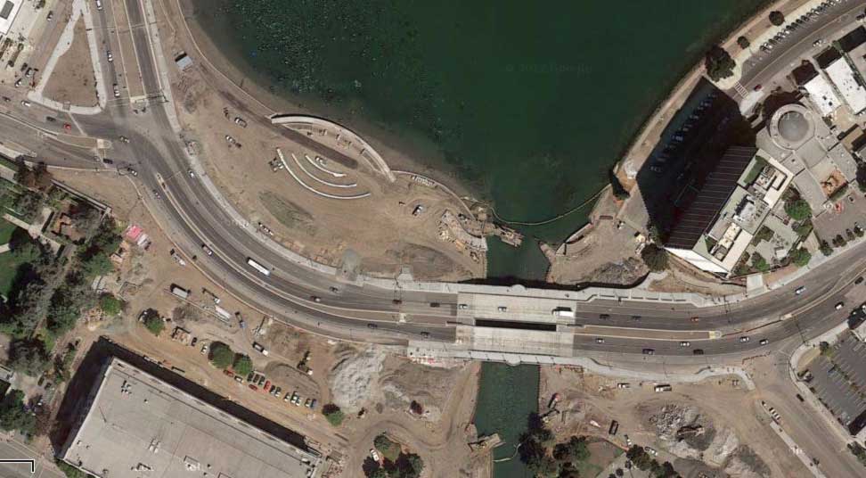
south end of lake merritt construction

Google Maps gives a nice unintentional before & after view of the construction along the south end of Lake Merritt in Oakland, if you turn the 45° aerials off and on.

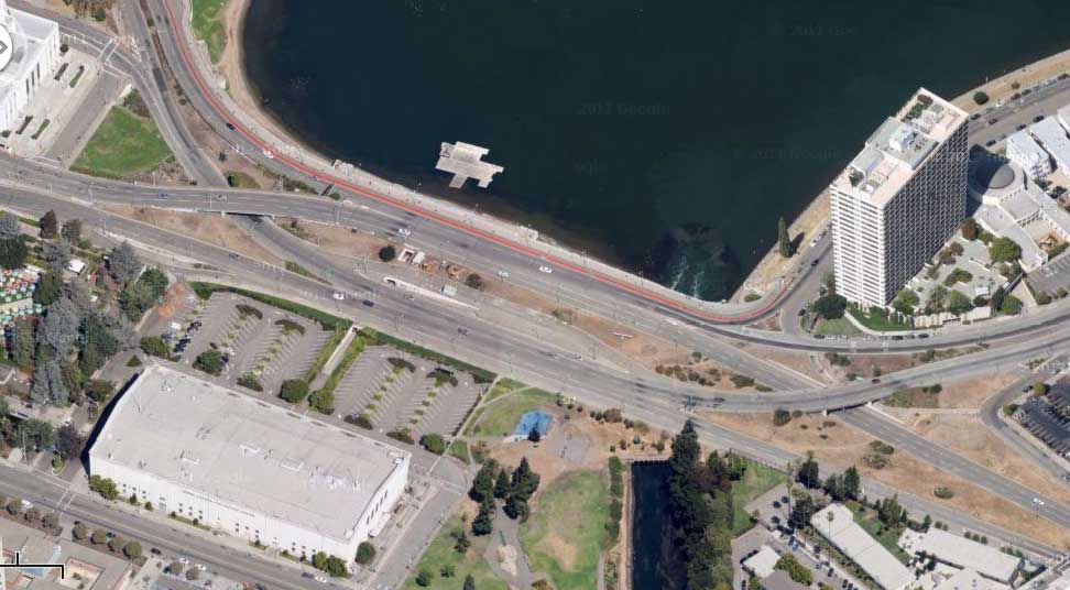
The gated-up and pissed-drenched pedestrian tunnels are gone. The connection to the bay is wider. There’s a separate pedestrian bridge, more grass, and proper crosswalks to the courthouse and museum.

More on the lake here and here.

Comments

Sorry, no new comments on old posts.

April 2024
Su M Tu W Th F Sa


Recent Entries

  1. Mapping Remote Roads with OpenStreetMap, RapiD, and QGIS
  2. How It’s Made: A PlanScore Predictive Model for Partisan Elections
  3. Micromobility Data Policies: A Survey of City Needs
  4. Open Precinct Data
  5. Scoring Pennsylvania
  6. Coming To A Street Near You: Help Remix Create a New Tool for Street Designers
  7. planscore: a project to score gerrymandered district plans
  8. blog all dog-eared pages: human transit
  9. the levity of serverlessness
  10. three open data projects: openstreetmap, openaddresses, and who’s on first
  11. building up redistricting data for North Carolina
  12. district plans by the hundredweight
  13. baby steps towards measuring the efficiency gap
  14. things I’ve recently learned about legislative redistricting
  15. oh no
  16. landsat satellite imagery is easy to use
  17. openstreetmap: robots, crisis, and craft mappers
  18. quoted in the news
  19. dockering address data
  20. blog all dog-eared pages: the best and the brightest

Archives