tecznotes
Michal Migurski's notebook, listening post, and soapbox. Subscribe to ![]() this blog.
Check out the rest of my site as well.
this blog.
Check out the rest of my site as well.
Jan 8, 2012 9:08am
new webgl nokia maps: progress
I’ve been kicking some files from the new Nokia 3D WebGL maps back and forth with Ryan Alexander, and my attempts to pick out the geometry are starting to get some results.
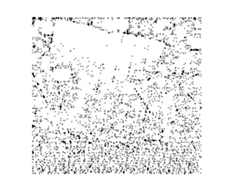
Nokia’s texture files:

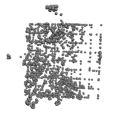
My points in those same files—a visual match!
Dumping a bunch of X, Y, Z’s into Mac OS X Grapher.app:
Ryan pushing the whole thing into Blender:
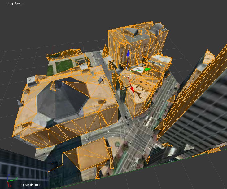
This model is actually two meshes, corresponding to two separate textures:


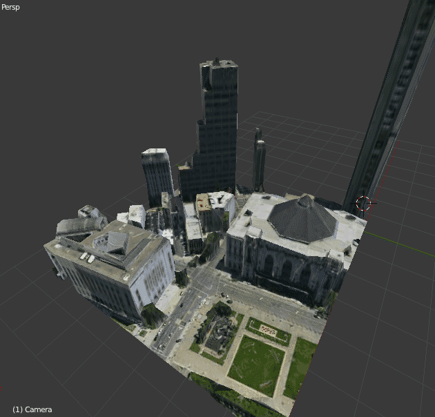
The first one looks a bit like a post-Tornado city. Now to figure out the mipmaps in the height lookup tables.
subscribe to ![]() this site.
|
contact Michal Migurski
this site.
|
contact Michal Migurski
Comments (6)
I'ma hafta report this incident... ;) (coooool)
Posted by Boris Anthony on Tuesday, January 10 2012 8:25am UTC
Please report it so someone over there can help me figure out the heightmap LUT. Actually I just might mail Gary about it myself...
Posted by Michal Migurski on Tuesday, January 10 2012 10:22pm UTC
Hey, did you get any further with this?
Posted by Mapguy on Friday, February 3 2012 4:47pm UTC
Hi Mapguy - I've had to put it aside for a little while, got busy with other things. I'll be returning to it in a few weeks, though, with a script that assembles these pieces into large .OBJ files.
Posted by Michal Migurski on Saturday, February 4 2012 9:48pm UTC
Michal, I had similar results and experience here: http://techbeyond.wordpress.com/2012/02/04/nokia-3d-webgl-map-experiments/ I m still struggling with LUTs and tiling scheme.
Posted by gpavlidi on Sunday, February 5 2012 12:37am UTC
Hi gpavlidi - I've posted to your blog as well, but thought it worth mentioning here that I've posted my own code (so far) to Github: https://github.com/migurski/NokiaWebGL
Posted by Michal Migurski on Sunday, February 5 2012 5:29am UTC
Sorry, no new comments on old posts.